
MOAB 240
October 13 - 18, 2023

“We are the Lucky Ones.”
Candice Burt said these words before the start of the Moab 240. She was referencing Stephen Jones who was the inspiration behind the Utah course. Stephen Jones died in an avalanche skiing in 2016. In 2017 Moab 240 was born.
At first thought “we are the lucky ones” seems to reference those annoying race signs one sees in a marathon. “you signed up for this” or “You PAID to do this!” I thought about this throughout this course over the 115-hour journey.
I knew I was lucky the moment I arrived in Moab before hearing these words. I was able to arrive a week early and relax, adjust, and enjoy the scenery before the race. I have always been drawn to the desert landscape. Having never been to Phoenix before, I ran my first 50k, Pemberton Trails, there in February 2020, before the world shut down with COVID-19. I wanted to run my first 100 miler there as well at Javelina, but it worked out that Rocky Raccoon was my first 100 miler in Texas. Javelina Jundred ended up being my first sub 24 hour 100 miler. That is still a magical experience because of how much I enjoyed that course. Everything from the landscape, to the stars at night, to the energy at Javelina Jeadquarters motivated me to run one of my best races. I figured Moab would prove no different.
Before even landing at Canyonlands Airport, I could see the La Sals. I thought to myself from the air “I am going to be running this. All of this.” My condo sat with a perfect view of the La Sals and I made sure to wake up every morning before the sunrise to get a glimpse as the sun rose over the peaks. I tested out running at various times as well just to get a gauge of the heat and how it changed with the sun position. It was the hottest between 3-5 pm.
I would also like to note that something else was happening in the world when I landed in Moab. October 7, 2023 is when Hamas attacked Israel. As this is still occurring now and still unfolding, I cannot comment other than, running Moab 240 seemed trivial to what was going on in the rest of the world. Someone made the comment: “when this is all said and done, I know I can go home, and my family will still be there.” This was not true for the people of Israel. This only echoed Candice’s words “we are the lucky ones.”
A lot of my anxiety was around packing. Packing to get there, packing my pack, and making sure my crew knew where everything was. Check in for the race involved medic check, gps check, and of course…gear check. I felt confident after the gear check as the guy said I was very prepared. I was also happy everything fit in my pack, including 3L of water. After the pre-race mug shots, all I needed to do was get a nice dinner, sleep (sleep in) and get ready to line up for the noon start. This year was the first year they moved it to a noon start to avoid the heat in the long exposed desert portions.
Below is my best attempt at a segment by segment recap of the race.


photo credit: destination trail
Start to Hidden Valley (8.29)
This part was probably my least favorite. And my least favorite in any race. It's when all the anxiety of the race just comes together and you can’t figure out if you are going fast enough or too fast. As you leave the start you head down 191 and within a block run down a side street in Moab. You are on the road for about 3 miles until you hit single track trail. This single track trail goes south along the mesa as you can still see Moab to your left. This would be a fun section to run if one wasn’t running 240 miles as the single track was rolling and consisted of switch backs around bends and curves of the mesa. I felt I wasn’t going fast enough but also I wanted to conserve my energy. From race reports, it was after this section that there was our first big climb, and I didn’t want to burn up on this part.
Hidden Valley aid station was probably the fastest aid station. Volunteers grabbed your pack, filled it with water, while we were left to grab some food. I grabbed some salty watermelon to eat there and a turkey sandwich to go. Otherwise, there was no sitting - it was a quick get in, get refueled, and get out.
Hidden Valley to Amasa Back (16.75)
The course reports did not disappoint…there was climbing immediately after Hidden Valley. Finally my curiosity was being fulfilled as I stared at these canyon walls for a week wondering how this course snaked up and behind the walls. This was a steep climb, but I had expected this. It was amazing at the top as we were now running the opposite direction from the previous single track. This area had a little shade and you could look to your right and get a better view of Moab and the La Sals from the top of the canyon. Runners also encountered Jeeps on this part of the course. I am not sure what trail this was but it was a popular off road section for the various sports in the Moab area.
My first “oh wow” section was the one mile downhill section consisting of slick rock. If you know me, I do not like downhill sections and was more nervous about this than the up hills. I have come to learn that slick rock is easier to run down than the dirt, rocks, and roots of the east and actually enjoyed this part. Instead of being scared of the height, I took in the view of the Colorado River in front of me and just the beauty of this course and what I was seeing.
At the bottom of the slick rock section, the course led out onto a road. Here it was sketchy as you ran right along the cars traveling from their various destinations. Some honked and cheered. Others speed by as if we were interrupting their vacation. To those that stopped and cheered, thank you. I could easily see up ahead the next aid station, where I knew I’d see my crew.
Seeing my crew was bittersweet. It was awesome as they had my pierogis ready for me with a chair and a change of clothes for the night hours. I also knew this was the last time I’d see them until mile 70…the next day. Restocked and fueled, I left with my music in hand ready for what the night would bring.

photo credit: destination trail
Amasa Back to Base Camp (29.08)
The next challenge I would encounter during this race was Jacob’s Ladder. I knew it was coming up as it was before base camp. This section was beautiful as it was on slick rock and looped along the Colorado River as you climbed higher and higher. In previous race reports, this section was referred to as what the course looked like in the videos and pictures, and they were not wrong. I really enjoyed this section. I will admit I was lucky running previous races over slick rock as I knew how to navigate the markings. I noticed the sun was starting to go down, and I still had not reached Jacob’s Ladder. I wanted to get to it before the sunset or at least not have to fumble with my headlamp on this part.
I reached Jacab’s Ladder right as the sun was setting. Enough time to see the daunting rock scrabble below me. In fact, below me I could see the headlamps of people approaching the bottom. I tried not to stare too long at where and how far I had to go down. Going down Jacob’s Ladder, a common theme started, “am I going the right way.” Scrambling over giant rocks, climbing over a natural gas pipe all while descending down a cliff seemed as though there was no real right way, as long as I made it to the bottom. I did have to put on my headlamp half way down. In all honesty, with my fear of heights, this was not that bad. The worst was at the top before you started, it seemed like you would drop over the end, but once you were on the switch backs, it was very safe. It was more difficult finding the correct path to the bottom.
At the bottom, there was a medic who greeted you and also guided you out. I looked back and it was completely dark now. I could see the people after me with their headlamps on as they navigated down the rocks. I thanked the medic and took off. This part was very runnable. I took advantage of my still fresh legs and the soft sand and took off with my music running. I passed several groups of people and felt confident with the course markings. I could see headlamps ahead of me signaling I was going the right way.
At one point, I passed a marker and then did not see another one. This was the first time I really needed to use my Gaia app and see where the trail went. Another group of runners showed up as I was figuring this out and together we got back on course. This is where I started to make friends and have conversations.
Base Camp was only 3 miles away at this point. Conversations at this point centered around other runners who had attempted this race and DNF’d. The “we are the lucky ones” jumped into my head again as I thought, will I be lucky enough to finish this on my first attempt? I listened to what went wrong, as A LOT can go wrong in 240 miles over roughly 5 days. I reminded myself to stay calm, take each challenge as it came and to keep pushing forward.
Base Camp was a dream. Not because it was an aid station in the middle of the desert but because it was a house, with an indoor bathroom, with hot running water. I thought, I can get used to this. Good thing I didn’t because this was the only time. The volunteers here were awesome as it was the first time I was offered made-to-order mashed potatoes. I filled up my bladders and realized how cold it was getting. I proceeded to get layered up and not hang out much longer. I noticed around the fire runners were being tended to with foot issues. Again, I felt lucky I did not have any foot issues yet.
I quickly decided to not stay any longer as I knew moving was my best option for staying warm and ultimately finishing the race. I proceeded off on my own and figured I would just make friends with the next person I found.

photo credit: destination trail

photo credit: destination trail


photo credit: destination trail

photo credit: destination trail

Base Camp to Lockhart (33.52)
This is where I ran into Doug. Doug was looking for a friend of his that he left at Base Camp. We decided to go off together as we were going about the same pace. Doug had also ran this race the previous year in 2022 where he made it to Bridger Jack. I stuck with Doug until we got to Lockhart. His one friend caught up to him and was taking more time refilling their water than I intended, so I carried on.
Lockhart to Oasis (53.56)
This section was 20 miles long. It was the section most dreaded in the previous race reports because there were no crew/pacers and the next aid was 20 miles away. I eventually caught back up with Doug on this section and several other people. It's amazing how in the dark we are attracted to headlamps and end up banded in groups.
I stuck with Doug for a bit before we started talking. I liked that he was not overly talkative, but the company was enough to get through the night. At one point, we turned off our headlamps and just looked at the stars. I had almost forgotten about this part of the course and how we’d be in the middle of nowhere, with no light pollution to see this beautiful sight. I could not take a picture of this to show how beautiful it was. My best description is that there were so many stars visible to the eye that one could not see the ones I could find easily. Doug also reminded me to look up with my headlamp on, as we were in the canyons (not sure if it was the Canyonlands officially) but huge rock formations were all around us. We just couldn’t see it due to the darkness.
Tristan and Logan caught up to Doug and I at this point. Logan was celebrating his 20th birthday tonight (what a way to celebrate). Tristan had just gotten in off the waitlist at the beginning of the week. The four of us made our way wrapping around hidden rock formations in the dark. In the distance, the very distant distance, I could see lights. Surely that could not be the aid station as it seemed like miles away. Surely enough as the sun started to rise and lit the canyon walls, I could tell that that was our aid station. I could also see for the first time the terrain we were traversing on, as we were high along the canyon ridges. I quickly learned to not care about this. We made our way down to Oasis and were greeted by the volunteers as the first night’s journey was over.
My first impression at Oasis was where the bathroom was located. Oasis was literally an oasis. We were told not to drop here if we could because it was not easy to get to and the aid that was there did not have room to transport runners. I feared when I asked where the bathrooms were as the thought of transporting porta-johns to this spot seemed impossible. “There’s a bucket over there where the teepee is.” A part of me thought, “I don’t need to go that bad” to “well we’ve come to this.” Oasis was the first aid station where I saw runners sleeping. I thought I’d rather sleep where it was a little warmer. I ate with Doug as Tristan and Logan got their feet tended to. The four of us left together to head towards Indian Creek as the sun rose to warm the land.


Oasis to Indian Creek (67.83)
This was a fun stretch as it got hot again. I was also excited to see the eclipse at 10 am. So I turned my watch to the time versus my mileage to not miss the event. This was a welcome distraction as I kept moving and almost made a game of getting to a particular spot before looking again. This road also seemed extremely long as I was excited to see my crew and take my first nap. I kept looking at rocks thinking it was an aid station. I could tell as I got closer, it was not an aid station. I felt it was close as there were jeeps on the road and there were bikers starting to appear. Civilization was approaching.
We climbed a relatively steep hill before rounding a bend where I saw the coveted aid station. I wondered how I’d find my crew. If they knew I was here and had no service to call and say I had arrived.
I was very happy to turn around and see Bernadette for the first time as the first night was over and I’d have my crew for the rest of the race.
I took a lovely hour nap here. I was able to change out of my clothes and tend to my sore feet. It’s amazing what a shoe change can do. FYI I had not changed shoes for a race yet. This is a trick I will keep in mind. I wanted to go have my blisters tended to but found out there would be a 40 minute wait. I decided to push on and seek attention for my feet immediately upon entering the next aid station. After refueling and eating, I went off with Kim for the next legs of the course.
Indian Creek to The Island (81.59)
I welcomed Kim as a pacer. I could tell her how I was looking at rocks and seeing other things. At least she confirmed what I was seeing and I was not hallucinating. She also read text messages she was receiving from back at home, which really lifted my mood. I had my phone on airplane mode and kept it on for the most part until this point as I was not getting service and I did not want to waste battery life. My phone was holding up great in terms of charging, which I would find in a few sections that my watch would not hold up as well. When we thought we were charging my watch in Kim’s van, it was not charging, and I was down to 4%. I could live without my watch, but I needed my phone for this course. I felt I could go without the watch. Which I could but it became frustrating not knowing what mile I was at and having to ask.
The first part of this section was on a road. Then we turned into an area of sandy washes. I remember following a dried up creek bed as some spots did have water. We then turned into Lavender Canyon as the sun went down. It wasn’t completely dark yet but the air started to cool as we weaved in and out of the marsh area. As the light slowly went away I could see the lights for the Island on top of the hill.
The Island aid station was where I received my first foot care. It was great as I was able to get some warm broth while I waited. My feet were getting sore at this point and the much-needed foot care helped. We then proceeded to go the way we came to the next aid station, Bridger Jack.
The Island to Bridger Jack (96.49)
This was the first time I started to feel really tired. I remember not wanting to rest in the dirt but I eventually gave in to my tiredness and told Kim I needed just 5 minutes as I felt myself sleep walking. We looked for a nice rock for me to sit on. I don’t know if this woke me up knowing when I found a rock I could nap but when I started to look for a rock, I couldn’t find one. Finally, I gave up and went off the trail and laid on what seemed to be an embankment to rest on. Just the short break alone helped and I decided to get up and go again.
This is when not having a watch made things more difficult. I had no idea where I was distance wise and had to ask Kim where we were at. I felt like a little kid asking if we were there yet. I tried not to ask only because I was disappointed when I found out there were 7 miles left. I believe this is the part that people stated in previous write ups that the section went on forever, I can attest that the dark and tiredness really weighed heavily here.
This was also the section where the limited light proved to be an advantage as we came upon a dead cow. I thought at first that it was a prop to scare away predators. It was the first time I had seen a dead animal that was completely gutted out with just the skeleton left with hair on it. My tired mind also did me a favor here as it did not scare or gross me out.
We finally made it to Bridger Jack where my immediate concern was sitting down and napping. Kim got me my first glass of apple cider. I am not a coffee drinker and for some reason apple cider sounded wonderful at this point. I wrapped myself in a blanket and sat by the fire, only to soon realize that it was colder sitting by the fire as the wind was hitting my back. Others must have felt my pain as people came in, they got out their emergency bivies to stay warm. I battled in my head to sleep or to get moving and stay warm.
After what seemed to be not much time but was way longer than I wanted, I realized that sunrise would be soon and this was proving not successful in getting my sleep. This was also the first time I took my shoes off and had difficulty putting them on. Kim had me wait for someone as he wanted to leave with us as we approached the next hurdle, Shay Mountain.
Bridger Jack to Shay Mountain (114.22)
I kind of enjoyed this section. As soon as we left Bridger Jack we were off the trail we were on before. We then proceeded down another rock scramble similar to Jacob’s Ladder but not as long or as steep. This took us runners to another dried up creek bed. This involved a lot of twisting and turning through the basin and over a tiny creek. We tried to avoid getting wet as we were still cold from the previous night. The sun was up but it had not risen over the mountains yet keeping the area cool.
The sun finally rose high enough to warm the land but also it was time to start climbing. We noticed there were two significant climbs where the first one was straight up. This was what I was expecting when hearing of climbing Shay Mountain. It was pretty straight up but I felt I was used to it from my training and previous races from this year. After what I thought was the summit, really the false summit, there was another section to climb. As I approached the next step I looked down and saw my first tarantula in the wild. I looked at Kim and said “oh hell no.” She thought I was referring to the hill. It was just the really large hairy spider in my way.
We made our way around the spider and finished the climb to the summit. Turning around we could see the Canyonlands behind us reminding me of where I had come from. The next downhill and uphill were on a service road which was a welcome relief. Now it doesn’t matter if it is a service road or rocky, I still hate the down hill. Kim and I continued to climb up to the Shay aid station where we were greeted by our crew and Luna (Kim’s dog) as well as two race photographers. I’ll never forget as they yelled at us that we were looking good. I replied that they were just being nice but their response was that “you are coherent which a lot aren’t at this point.” That made me feel good.
Feeling good that I got that climb over with, I did not spend a lot of time at the van. I changed my clothes and shoes. Checked my phone as this was the first time I had cell service. I really just rested my mind here for a few minutes as I had more watermelon. I really just wanted juicy salty watermelon when I reached the aid station. I was ready to go out and finish the section on Shay Mountain.

photo credit: Kim Auth

photo credit: Kim Auth

photo credit: destination trail

photo credit: destination trail

photo credit: destination trail
Shay Mountain to Monticello Lake (126.42)
This section was fun as it was single track and relatively runnable. It was beautiful scenery through the golden aspens over the ridges of the mountain. This was the first time I would exceed 10,000 feet on this course. It was also beautiful to watch the sunset over the mountains in the distance. As we ventured back down the mountain and onto the roadway, the temperature significantly dropped. I layered back up before it got really cold. This section also had some snow and ice on the trail. A reminder of how high we were and the storm that came through earlier this week.
I took a small fall near the bottom of this section before getting on the road. Nothing significant but enough to go to the aid to have it tended to before starting the next section. This section was also one of the shorter ones at only 12 miles, and that seemed like a very welcome change.


photo credit: destination trail
Monticello Lake to Dry Valley (143. 82)
I traded Bernadette for Suzanne for the next section. This section was 18 miles, I was pleased with my pace during this section and excited that I would soon be back at the van and able to nap before sunrise and hopefully get 2 hours of sleep.
Suzanne and I got off to a quick start feeling confident. After about 2 miles we were supposed to turn off the access road. We noticed this distance but never saw a turn. Still heading down the road, we realized about 1.5 miles later that we HAD missed the turn and had to back track 1.5 miles. I did the sleep math in my head, and realized that I had lost an hour of sleep. I tried not to get discouraged, but I struggled to keep up to make pace.
I felt we were dead last as when we left the aid station it was 10:30 and the station closed at 12:30. Not seeing anyone behind us, my mind went to thinking that we were dead last. I also feared the cut offs for the next aid station and that I wouldn’t be able to sleep at all. A new spark grew inside me as we started to pass people on the trail sleeping. I also double-checked my cheat sheet with the cut-offs which reassured me that I would make the cut off times. I also got a second wind as people were waking up and attempting to pass me. I took each stride and increased the pace fast enough to beat Kim to the aid station with the van.
Back at the aid station, I immediately went to the medic tent, because it was warmer, and to take care of my feet while I waited for Kim. I knew my blisters needed tended to. The medic there mentioned how I was losing my toenail and if I wanted her to rip it off. Without thinking, I said yes and it was gone. I immediately thought of my friend Cindy and how during one of her 100 milers she ripped her own toenail off as the medics would not do it. I know I couldn’t do that myself. I felt relieved that it was done and then settled in for an hour nap before dawn.
Dry Valley to The Needles (157.74)
I woke up after my hour nap to a chilly morning but knew this would not last long as the next section was full exposure for the next 26 miles. This overall was a good thing as Kim and I made up for lost time. We had fun picking up the pace and finding people to pass. I know Kim counted how many people we passed but I was more focused on finding the next aid station.
The Needles was the diner aid station. The tables had red and white checkered table clothes and food was made to order. I remember Kim got a grilled cheese with avocado sandwich. That sounded good at the time, but I had no real appetite. It wasn’t that I didn’t want to eat, I think I was too tired to eat. I basically ate to fuel myself at this point. The best memory I have from The Needles was that I was asked what I wanted to drink, and I asked for coke. And the response was “warm or iced,” “flat or carbonated?” Now that is service.

photo credit: destination trail

The Needles to Road 46 (170.0)
Again Kim and I were back on the road for the remainder of the 26 miles. I remember at this point having a beautiful view of the La Sals and thinking, “I am going to be up there running in a few hours. How am I going to get from here to there?” The next several miles were definitely exposed and we did pass a few more people. Kim even admitted that she understands how people can hallucinate in the desert heat when there is no shade. We passed the FU Coyote Ranch and the Looking Glass Mesa. Other than that, it was just a long stretch in the sun.
Road 46 aid station was moved farther down the road due to overgrowth at the previous spot. I got changed and rested before making the climb up the La Sal Mountains into Pole Canyon. Bernadette joined me for this section.
Road 46 to Pole Canyon (185.51)
I was both nervous and excited about this section. I knew I could make ground on the climb up to the Pole Canyon aid station. This section boasted 3446 ft of climbing. Going into the night, I doubled up with a fleece and my middle range Rab coat. At first I threw the fleece in my pack as I did not need it as I started to climb pretty aggressively from the start. This section was also rocky to start which I did not care about as I wanted to make up time. It was also at this time that it was getting dark and the night sky was putting on the display of stars again for the fourth night. I looked up and finally saw my first shooting star of the race. I can say now that I made the wish to finish this race. In a way, seeing this gave me more confidence that I could do this. It was neat as the night came, one could see the stream of headlamps up the mountain.
As I was climbing, I was passing people and Bernadette struggled to keep up. I told her just like the previous section, she could catch up as she caught her breath. I got to the point where I kept passing people. There were then two gates that needed to be opened and closed. As I went through these sections, I noticed that no one was behind me…including Bernadette. I double checked my map and was on the right course. I continued to go on but was concerned about Bernadette. I decided to check my phone for service, as I had it on airplane mode most of the race. I finally found both service and a hot spot on the mountain. In the desert at night, you will find that there will be cold air and an area of heat. I decided to stay in this warmer section with the warmer air as I called Bernadette to check on her. Luckily within 5 minutes, I could see headlamps approaching me. I could hear Bernadette and I was so happy to see her. I hugged her but she was struggling with the climb and was not confident heading into the next section with me. When we got to the aid station we looked at what options she had to drop.
At first the guy checking us into the aid station did not know what she could do and said she HAD to stay with me as a pacer. We found the aid station captain who let Bernadette stay as she offered to help and then would go with the rest of the volunteers back down the mountain after the aid station had closed at 5:30 am.
Once Bernadette was taken care of, I looked for my next options for leaving. I looked around and noticed how some people were settling in for a nap. I was wide awake and did not want to waste time and get cold in the night air. I grabbed something to eat and decided to leave after I finished my food. The aid station captain led me out with directions to look for lights among the trees leading the way to the trail. I was happy to leave as the actual trail was warmer than the aid station. Worst case scenario I could take a dirt nap and set an alarm.
Pole Canyon to Geyser Pass (200.51)
This section was only 15 miles. I forgot to calculate the 4916 ft of climbing which was all above 10,000 feet of elevation. I realized that I was literally running along the passes of the La Sals. I thought to myself to make it out of these ridge sections before dawn due to the height and the openness of the passes. This section involved three big climbs with three downhills. The first climb was the steepest and the last downhill was the steepest and longest. I made my way through the forest and ridges passing people with their pacers who were taking breaks. I felt good making up ground in the dark.
As daylight approached it almost got colder. I was on the opposite side of the mountain from where the sun rose. I could also see spots where there was snow and ice left over from Wednesday’s storms. I was also taken aback by the beauty of being up there as the aspens were losing their leaves but also showing the white caps of the peaks. I came out to the top and noticed I could see west down to the town of Moab. This was when I stopped.
I looked to see if I could see Arches National Park and then I looked and saw Moab and realized as I panned left, I could see where and how far I ran. I stood there in awe of what I was looking at. I could hear people behind me approaching but I really didn’t care as I just took in the moment.
I left with the idea of hitting the road and hopefully approaching the next aid station and meeting back up with Suzanne and Kim. When people talk about this section, they also say it goes on and on. And that is not a lie. You do hit a road but that road leads back onto trails that weave and turn and spit you out into another section that weaves and turns. The hardest part was climbing up rocky trails. Near the end of this section is the burned out section from the fire. It was very runnable and shaded. As long as this section continued to go on, It reminded me of how this course really did show you EVERY part of the land. From deserts and canyons, to mountain passes, through tree lines and through golden aspens, we runners truly got to experience the beauty of Moab.
I finally saw someone walking their dog who confirmed the aid station was just around the corner. Luckily this guy was correct and the trail spit me out into the parking lot. I met up with Suzanne and Kim for some more vegan sausage and much needed foot care. The point with the vegan sausage is that at Pole Canyon, it was the first time I had heard this as an option. I was excited for a new food option. And now that was my go to.
I was also excited to be at Geyser pass as other runners were leaving their crew and heading on to the next section. This was also mile 200.51. Finish or no finish, I had run 200 miles. Runners who were leaving for the next section congratulated me on making it through the previous section as it is a “soul crusher.” I honestly felt that despite it seeming longer than 15 miles, it was the most beautiful section. I was also told that if I had made it to this point, I was pretty much guaranteed to finish. One woman said “we are heading out on our victory lap” referencing the last 40 miles to the finish.
I decided not to take a nap, and Suzanne and I headed out to finish this thing and proceeded on to Porcupine Rim aid station.


Geyser Pass to Porcupine Rim (221.51)
This section started climbing but it was easy to navigate as it was mainly road. We then proceeded back down the mountain, passed two alpine lakes and eventually to a campground area. There was one more big climb before we came out onto another road. This was beautiful as we were given a panoramic view of the La Sals. In front of us we could see the Wasatch Range in the far distance.
This road seemed to continue forever but again was very runnable, or what was very runnable after 200+ miles. Suzanne and I saw a beautiful sunset. I kept thinking to myself, I can come back to this spot tomorrow and actually see it while NOT running the race.
Once the sun set and the stars made their 5th and final appearance for the race, we continued down this road and then onto another dirt/access road. The night provided us another visual of who was out with us as we could see headlamps in the distance both behind and in front of us. I kept hoping that I would see the lights for the aid station but as we continued on, I did not see any lights. My watch at this point had lost power again, which added to my struggle as I had no idea how far we had traveled or how far the aid station was without asking. One runner passed and said it was 3 miles away. At this point, 3 miles was over an hour and that is not exaggerating.
We finally got to the Porcupine Rim aid station where I found a nice spot near the fire. I was covered with a blanket and took off my shoes to rest my tired feet. I ate a little and decided a 20 minute nap was much needed before heading out for the last 18 miles to the finish.


Porcupine Rim to Finish (240)
This section concerned me from the start as we were running on sandy slick rock. This was not soft on my already tired feet and made running fast nearly impossible. I was also nervous as people had warned me about Porcupine Rim as the first 10 miles were double track but then the last 5 were single track with a steep edge into the canyon. This section also involved what I want to call bouldering as one was more or less climbing down the canyon walls. I am thankful that I did this section at night because I could not see the drops nor realize how high up we were. This section was extremely difficult at this point as it was hard to make progress given the terrain. Suzanne looked at the estimated time which had us finishing after the cut-off but we knew we were fine because once we got off this section, it was a 5k on the bike trail to the finish.
After what seemed like forever, we finally saw the top of the porcupine rim trail which led down to the tunnel onto the bike trail. The end was near! Suzanne stated we had an hour and a half to do 3 miles. I took off running/swift walking as I wanted this to be done. It was also approaching dawn. I have learned through this journey that dawn is the coldest time of the day and after nearly 5 days of this, I was done being cold. As we approached the city limits of Moab, cars flew by us honking. It honestly felt very surreal at this point. I really didn’t comprehend what I had just done.
As we got closer to the turn into Sun Arches RV park, small crowds of people formed. Looking back I was more baffled at why these people were cheering for me. It had not sunk in. I could hear people yelling “we have a runner coming” which felt like a long time as we twisted and turned through the parking area. Finally, I made that last turn which was the road down into the park which I remembered from the start of the race. I was here. I was at the finish. All I had to do was cross the finish line and I was done.
I stood in awe as I finished as I could finally stop running. The one woman from the aid stations, who took care of my feet, yelled out to me “is this the infamous Kat?” That caught my attention because I quickly recognized her. The last time I saw her, she told me she’d see me at the finish and she kept her promise. That is when it hit me that I had finished the Moab 240. This was the glory moment as I got to pick the coveted buckle from the table and get my finisher mug shot.
My phone blew up with texts as people from home had been watching the live stream. I realized how lucky I was that I had such a supportive crowd cheering me on and people supporting me at home. I have some pretty AWESOME friends.
To go back to the start of the race. “We are the lucky ones.”
This phrase has stuck with me through the race and now several days later.
I am lucky because I am healthy to do this.
I am lucky because I could do this. Not just physically, but that my job allowed me. My obligations at home allowed me to go away for 2 weeks.
I am lucky because I got to see firsthand the beauty of this area. And it really is beautiful. I want to come back and not run a race (or at least not 200 miles worth) and just be a tourist.
I am lucky because I have friends who took time to crew and pace me for this.
But as much as I sit here and think about how lucky I am. I also think about the word “luck.” Because it's not just luck. We do have free will. It is not all luck - it is determination, perseverance, and resiliency that gets us through hard times. We make our luck. I am lucky because I am privileged to be able to compete in these events. But I also worked hard to reach my goals and that is where it counts.

photo credit: destination trail
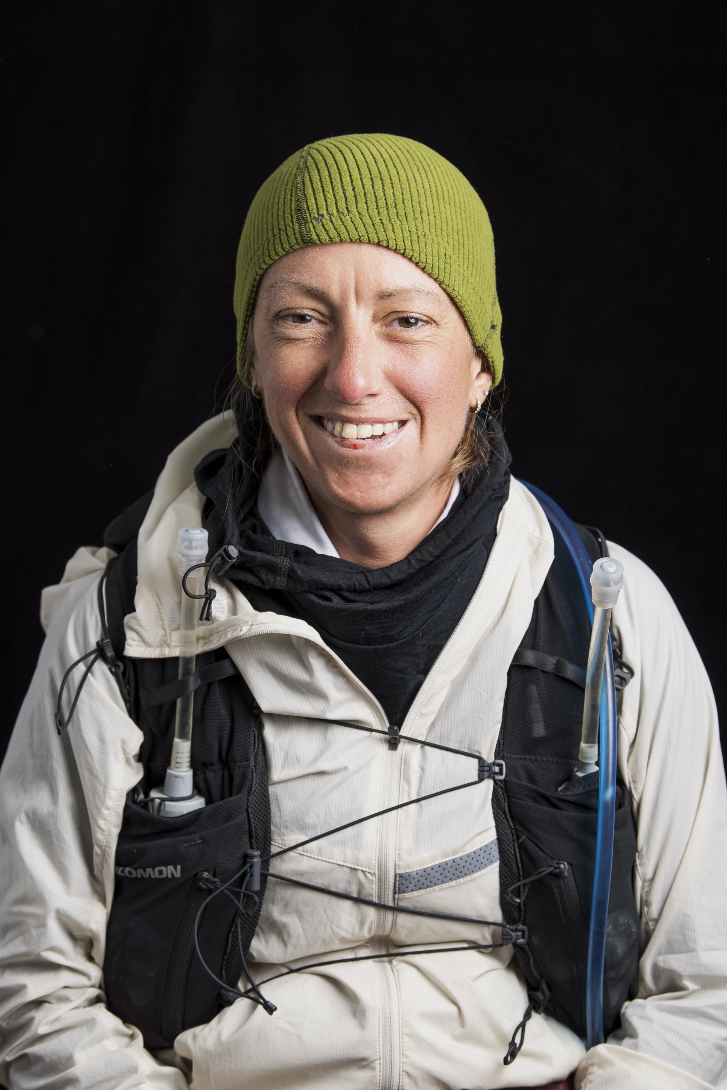
photo credit: destination trail
*Any photos that there is no credit for I personally took